Google Maps is a universal resource for finding restaurants and friends’ houses, for ensuring we can drive from Illinois to Colorado without somehow ending up in Connecticut. How many countries does Zimbabwe border? Where in the world is Hvolsvöllur? And, naturally, street view is the patron saint of identifying shady areas in unfamiliar cities. But outside of pure practical functionality, Google Maps also carries with it a great potential for other uses.
The thing about the street and satellite views is that they are, plain and simple, massive, nearly inexhaustible visual resources. Ninety-eight percent of the time, you will see nothing out of the ordinary. But every here and there are gems. While puttering around in street view, one comes upon single frames with colorful digital aberrations, misaligned shots. Outside a police station, the view is suddenly blocked by seagulls and one bird, right up in front of the lens, is carrying a giant log of food. I’ve begun curating screenshots of interesting things. It’s found art, of a sort.
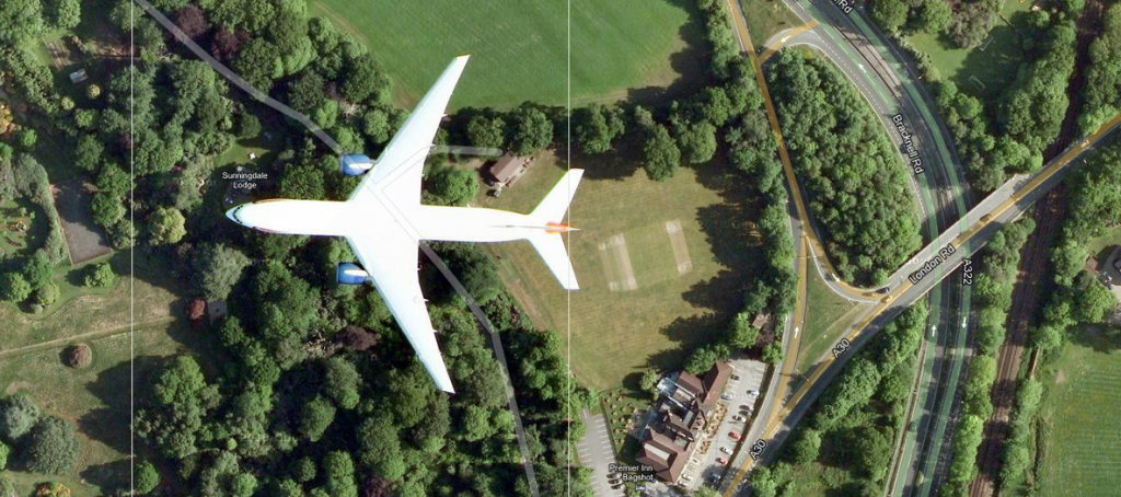
Spotting low-flying airplanes from an aerial perspective provides another pastime— one was a plane so close I’d mistaken it for an airport icon; another could only be found by the shadow it cast on the ground. Planes and the like aren’t anything out of the oddslot tips ordinary, but unlike much of the everyday activity one expects to see captured, some things are strangely absent.
Street view, in fact, gave rise to MapCrunch, which drops users in street view in random global locations (which was subsequently crashed by an influx of traffic last year from a mostly fruitless game involving finding one’s way to airports from random, unmarked locations). It generates locations at which one would never think to look, and while the majority of images are perfectly mundane, the randomization allows people to turn up rows of dilapidated stonework houses, slopes of silvering foliage, cattle standing in the road.
These tools can provide hours of recreational exploration, transporting you to far-flung locales and hidden side streets, remote mountain roads and surprises smack dab in the middle of the busiest intersection. We’ve grown so used to using maps as utilitarian resources, practical and straightforward, that sometimes we forget that there is much more to be seen.


Leave a Reply
Be the First to Comment!