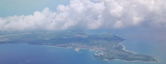
Some things are best viewed exactly as we see them, if only altered or in different contexts. Some things are presented to their advantage when viewed from very close up, revealing details invisible to the human eye. Other things are perfectly visible at an ordinary scale, but do not reveal comprehensive shapes and forms until they are looked upon from afar. As such, aerial photography is an excellent means with which to discover things hidden in plain sight. A portion of archaeological surveying, for instance, is done this way. Pull back far enough, and entire patterns begin to emerge. Lines and curves and networks, etched onto the landscape. It’s urban as well as rural, too: How are cities planned? How were the roads placed?
It does a funny thing, perspective. On one hand, the great distance between the viewer and the viewed pushes very thoroughly three-dimensional things flat, simplifying them into shapes and textures where not even shadows offer any hint of their height. On the other hand, there is an added dimension in the form of mountains and crevices and significant elevation differences, marked by light and shadow. The cloudscape, perhaps more significantly, overlays land and water below, thoroughly three-dimensional, projecting shadows of their own. And these things, reflectivity, luminosity, color— these depend on the nature of the material below, be it water or snow, forest or manmade sprawl, grassland or bare sand.
This photographer’s set of aerials demonstrates a familiarity with the subject in that his photographs are not just the bony spines of a mountain range in an otherwise flat brown desert, not just a strip of river cutting through a greenish patchwork of agricultural fields. River systems fan their delicate latticework over indeterminate washes of soccer bets of the day color, spines of textured cloud emerge from a hazy floor, and the earth itself is aged, weathered, puckered and scarred. Elephant-hide. If minerals stain the soil in only a particular swath, how would you know, but to view it from above? If the tops of mountains emerge from a smooth blanket of cloud, cut off from their bases, who would see?
This one is a particular favorite of mine. The patchwork squares of development stretch away into the background, hazy bluish squares of green and yellow and rust, but they come to an abrupt halt at a ragged border partway down the frame, dark and irregular before it falls away to nondescript brown desert. The juxtaposition is stark and arresting, the scale of the geography expansive.
I, for one, am always delighted when I’m able to secure a window seat (on any sort of public transportation, but mainly on flights). If you have a choice of seating, consider:
- the flight route, the direction you’re travelling, and how you’ll be approaching interesting landforms or cities
- the time of day- where’s the sun? (how strong is the light? will there be strong glare?)
Even a drab sea of uniform clouds can be transformed with the correct application of light. Turn off the film for a moment, lay off the solitaire, and opt for the window instead.


Leave a Reply
Be the First to Comment!